Accuweather Stargazing Forecast – 5 Day

Tonight
Night 2
Night 3
Night 4
Night 5
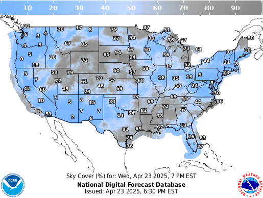
NWS Cloud Cover Forecast - 7 Day

Current Infrared Satellite Map
This infrared
satellite map can be viewed day or night. Clouds will show up as white, and clear air will generally be darker. Infrared often doesn't show you thin clouds or low-lying clouds such as fog. But it is the only option for seeing where the clouds are at night. Mouseover a region of the map to zoom in. Click to open another window with an animation showing the clouds in motion.

Comments are closed, but trackbacks and pingbacks are open.